The Underline: Spine of Miami Trail Network
Florida recently ranked the second deadliest state for pedestrians, making Miami-Dade among the most dangerous places to walk, run, or even bike.
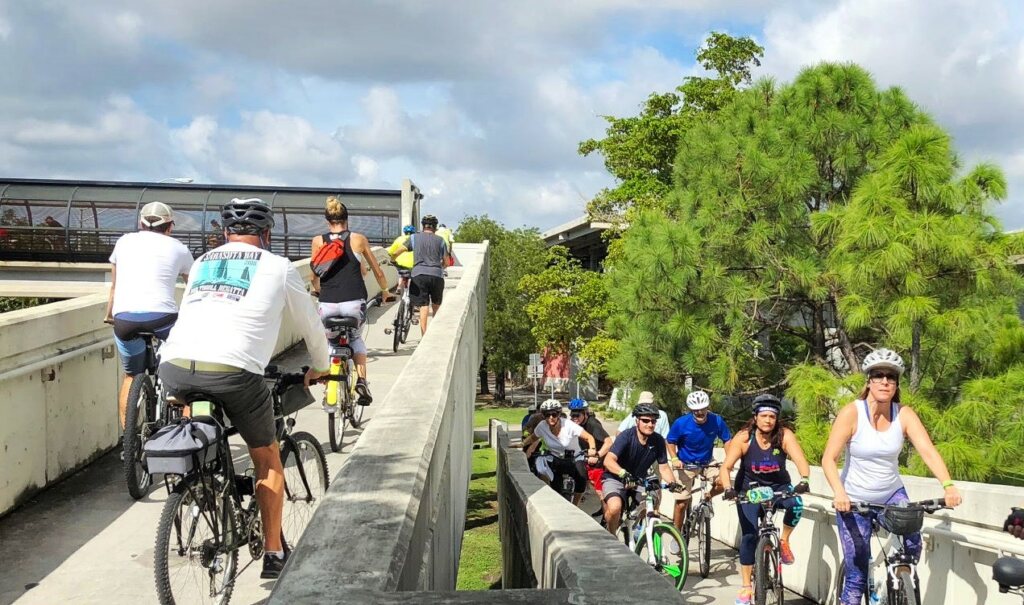
Miami residents and visitors flocked to the streets during the COVID-19 quarantine. But they weren’t driving, and the roads felt safe so they walked and biked as a way to be outdoors and exercise safely.
Elected officials and city/county planners paid attention to the community’s demand for safe walking and biking infrastructure and are working on a countywide trail network to meet today’s and future demand.
Thanks to partnerships with Miami Dade County’s Department of Transportation and Public Works, The City of Miami’s office of Capital Improvements, the Miami Downtown Development Authority, there are multiple transportation projects underway that will connect communities while providing much needed access to public green space and multimodal transportation.
As The Underline continues its 10 mile expansion, we are proud to be part of this growing network of transportation trails and corridors that reshape how Miamians experience the outdoors and mobility.
Baywalk
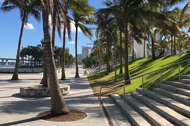
We’re so excited to share that the City of Miami Government Office of Capital Improvements and the Miami Downtown Development Authority are advancing the design of an over-the-water pedestrian bridge along the downtown Baywalk that will finally connect Maurice A. Ferré Park, Perez Art Museum, and Frost Museum of Science underneath the MacArthur Causeway to the Resorts World/Genting property.
The Baywalk is a pedestrian and bicycle-friendly trail along Biscayne Bay. A new pedestrian bridge will provide equitable north and south access along the Baywalk and much-need safe pedestrian and cycling connections to the future Underdeck, the Miami River Greenway, and The Underline.
Miami River Greenway
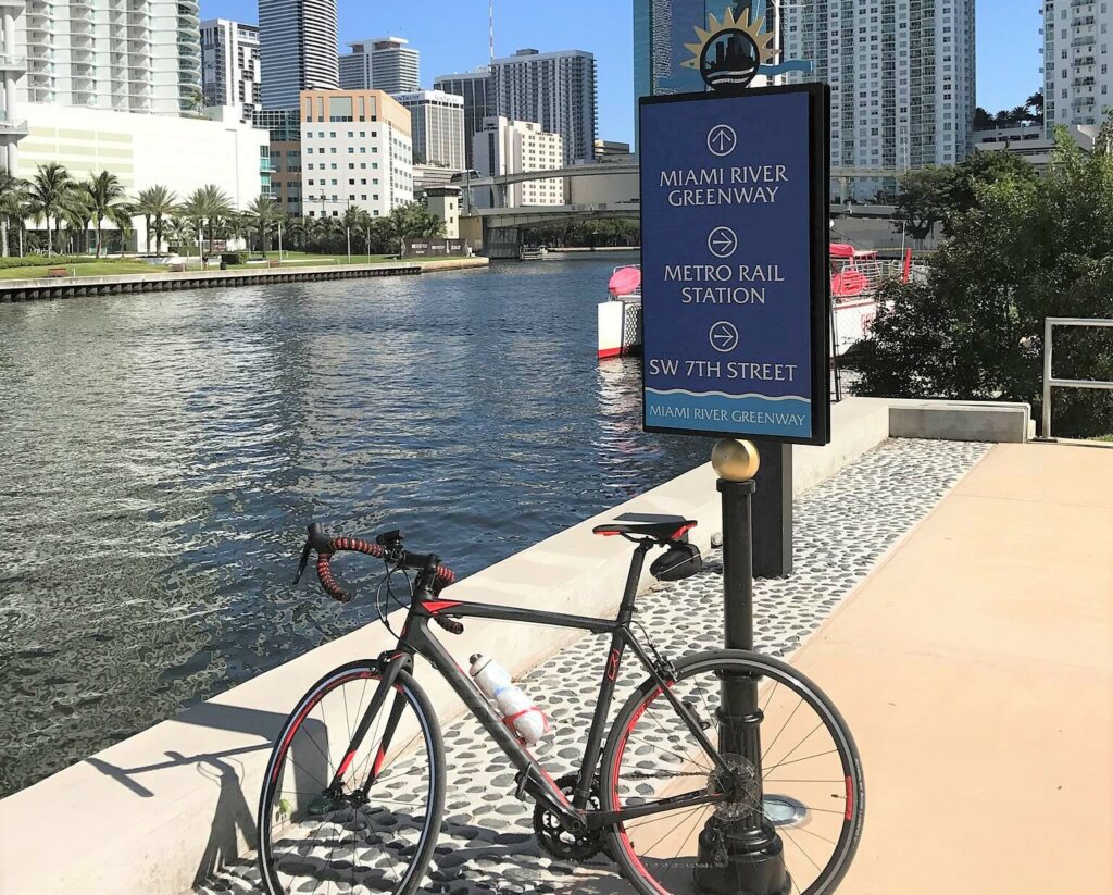
Years ago, the Trust for Public Land created a master plan to turn the uninviting shores of the working Miami River into a string of parks, playgrounds, and pathways that will connect communities to the historic river.
The Miami River Greenway is a planned 10-mile, scenic trail with views of the river and the city’s skyline. Currently, just over half of the trail is accessible to the public and new segments are in progress.
With historic markers, plenty of signage, and informational kiosks, the Miami River Greenway will showcase public art, bring the community together, and provide an alternate form of transportation that reduces vehicle traffic. The Greenway currently includes a small beach, an amphitheater, a playground, and recreational activities. Further south, the greenway travels through Jose Marti Park, and boasts an outdoor gym, a pool, playground, basketball courts, and ballfields. Eventually, the Miami River Greenway will follow the river to Palmer Lake located near the Miami International Airport.
Ludlam Trail
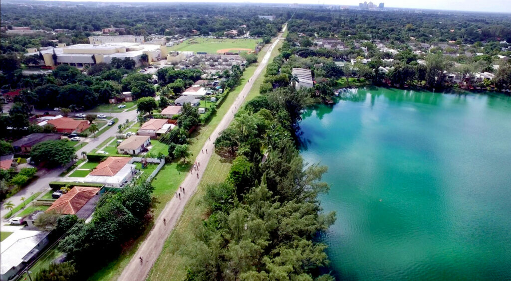
Meet Miami’s Ludlam Trail: a reimagined abandoned Florida East Coast Railway corridor that runs from Dadeland Station north to the Miami International Airport for 5.6 miles, ending at Dadeland Station providing future commuters access to the Metrorail and The Underline!
With four public schools in the area, Ludlam Trail is creating the opportunity for thousands of children to walk and bike to school in a safe, green space.
Led by Miami Dade County’s Parks, Recreation and Open Spaces Department, the project went through a robust public input period for community input.
The Ludlam Trail will provide our community with a shared-use trail that includes safe, dedicated, direct pathways for walking, running, and cycling, encouraging healthy lifestyles and the use of alternative transportation, and enhancing overall connectivity and accessibility between schools, parks, transit stops and residences, workplaces and more.
Commodore Trail
Did you know The Underline will soon connect to the Commodore Trail (@commodoretrail) at SW 26th Street in Phase 2? This historic trail in Coconut Grove is a five-mile route for pedestrians, runners, and cyclists from Coral Gables’ Cocoplum Circle to Key Biscayne Rickenbacker Causeway. The trail serves our communities by connecting Edgewater, Douglas Road, Main Highway, and South Bayshore Drive.
The Friends of the Commodore Trail, with the City of Miami and Miami Dade County, are creating a Master Plan that will increase the safety of walkers, runners, cyclists, and motorists in the area by designing safe crossings and pathways that balance competing needs. Design improvements will enhance and protect the Trail’s natural beauty and make its maintenance easier.
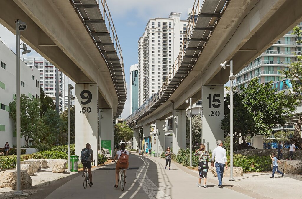
The Underline
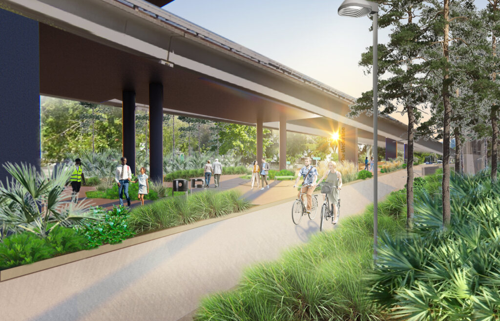
The first phase of The Underline opened to the public on Friday, February 26, 2021. Named the “Brickell Backyard,” this first segment of the 10-mile linear park and trail is half a mile long and runs from the Miami River to Coral Way, encompassing the northernmost portion of The Underline. The award-winning design for the Brickell Backyard by James Corner Field Operations (@fieldoperations) is organized by a procession of “rooms,” each articulated with a unique program and design intent that directly responds to its immediate context and to the needs of the local community.
Phase 2 of The Underline (pictured in above rendering) is a 2.14-mile segment that connects SW 13th St. to SW 19th Ave. Construction began in Fall 2021 and is expected to be completed in the summer of 2023. Phase 3 will be the 7-mile stretch from SW 19th Avenue to Dadeland South Metrorail Station and is in the procurement, or contractor selection process.
Visit our website at theunderline.org or our Instagram page @theunderlinemia for more news and updates.