Bright Horizons: Florida’s Miami LOOP
“In a big urban area like Miami-Dade, connectivity is very important.” —David Henderson, Intermodal Manager, Miami-Dade Transportation Planning Organization
This 225-mile trail network project throughout Miami-Dade County is taking the region to new levels of transportation, health, and economic and environmental resiliency.
At barely 6 feet above sea level, and with urban development at maximum capacity, Miami is virtually at “ground zero” when it comes to climate and mobility issues. But as the city looks forward, it has plans to elevate itself as it seeks to both strengthen and connect its diverse geography and infrastructure.
Local experts say numerous steps are underway to make the community more resilient. Among them is a move to build higher streets. Also in the mix and gaining momentum: the Miami LOOP, a cross-county trail system being developed by the Miami-Dade Trail Alliance, which was formed by Rails-to-Trails Conservancy (RTC) in partnership with The Miami Foundation and more than 20 local organizations and advocates.
Termed by one state trail advocate as “an extraordinarily brilliant idea,” and with plans to link a network of existing trails and planned routes, the LOOP would cut a 225-mile triangular path through Miami-Dade County with a grand vision to “expand transportation options, make biking and walking safer and more equitable, strengthen the regional economy, reduce the area’s carbon footprint, and improve health and wellness” across the region.
Safety + Connectivity = Transformation
Ask about walking and biking safety in Miami, and the experts are fairly unanimous: Miami is not considered by some measures to be a biking- or pedestrian-friendly community. Ken Bryan, RTC’s senior strategist for external relations and the director of the Florida Field Office for nearly 26 years, said that although the area does have a robust cycling community, “it’s a shifting demographics, and the infrastructure is playing catch-up.”
Stuart Kennedy, director of program strategy and innovation at The Miami Foundation, said the city has the fourth highest pedestrian fatality rate in the country, and for many cyclists, the streets of Miami feel dangerous. But with better bike infrastructure, he predicts, “we’ll start to see better awareness.”
That’s where the Miami LOOP comes in.
According to Bryan, the endless new connections made by completing the trail network’s primary corridors—which include world-renowned beaches, a river greenway, and multiple old rail lines—will create new opportunities for walking and biking mobility throughout the county and help decrease the area’s dependence on automobiles.
Circling around the bottom half of Miami and heading up through Miami Beach and points north, the LOOP will seamlessly connect to major sites such as South Beach, downtown Miami, the Port of Miami, and Biscayne and Everglades national parks. Further connections accessible via the LOOP will extend south into Monroe County and north into Broward County.
Dale Allen, executive director of the Florida Greenways & Trails Foundation, believes the LOOP is an exciting idea. “It is one of those extraordinarily brilliant projects,” said Allen. “We’ve got to make it safer and more enjoyable for people to move around on their own power, and in a less intensive way than the car-centric way we do now.”
David Henderson, intermodal manager for the Miami-Dade Transportation Planning Organization, attributes Miami’s historical challenges with trail connectivity, in part, to its “sprawling, urban style of development.” For decades, Florida’s developments often did not factor in trails and open spaces.
Bryan agrees. “Anywhere in Florida, traditionally, it was an afterthought,” said Bryan. “But over the last decade, communities are changing and wanting these things.”
He added, “We’re talking with developers and with the city about incorporating trails on the front end of commercial and real-estate development—in essence setting the expectation that trail-oriented development is the norm.”
And there is plenty of interest among developers.
“There is so much opportunity because of all of the building that is happening in Miami,” said Liz Thorstensen, vice president of trail development for RTC. “We’re still in the process, and there is definitely interest there.”
Boosting that effort are the habits and demands of young urban dwellers, who often prefer walking or cycling to driving a car. “As some neighborhoods become denser, younger people, millennials, are attracted to those areas,” Henderson said.
And with them comes the need for better trail connectivity.
Frankie Ruiz, co-founder of the Miami Marathon, sees the Miami LOOP as a way of fostering a sense of community in a city that can sometimes appear transient. “It gives people a little more pride to be able to say, ‘Yeah, we have that,’” he said.
Ruiz has seen that phenomenon while traveling to marathons in other major cities. “I started to realize that Miami was missing something,” he said, noting that options for long, uninterrupted runs are limited in Miami. “Somebody forgot that. They were too focused on the beach.”
But over the past decade and a half or so, things have evolved. “A lot has happened since the marathon started [in 2003],” Ruiz said. And he is excited about the prospect of such up-and-coming trail projects as The Underline and the Ludlam Trail—both of which will allow for long, sustained running and biking without traffic interruptions.
The Underline: A Hidden Gem
The genesis of The Underline dates back about four years, when Meg Daly, now the president/CEO of Friends of The Underline, had a serious biking accident. She broke both of her arms in the crash, but, Daly said, “like everything, there was a silver lining.”
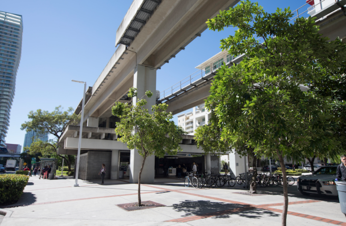
Suddenly, she could no longer bike or drive a car, and she took to walking beneath the Miami Metrorail to get to her physical therapy. A lifelong resident of Miami, she had no idea that the asphalt path—known as the M-Path—existed before the accident.
Although the M-Path served the purpose for Daly, she said the basic paved path wasn’t the most attractive or enticing spot to walk or ride. “The difficulty is the crossings,” she added, pointing out that users must deal with about 34 intersections. “There is a lot of graffiti, and the trail meanders, which is bad for visibility. A lot of people simply don’t ride there.”
Still, Daly saw potential. “I saw all of this land, and I thought ‘why aren’t we doing more with it?’ To me, it was a hidden gem, and we had to polish it up,” said Daly.
That started what became a mission for Daly and a host of other advocates—to create a 10-mile linear park, complete with two parallel trail lanes (one for bikes, and another for pedestrians) and a network of neighborhood gathering spots in the shady right-of-way beneath the Metrorail. Ultimately, the rail-with-trail will serve as a major hub for both public and active transportation.
It will be no small task. Estimates have the cost for the full 10 miles at between $90 million and $120 million. But the first phase of improvements—3 miles starting in the Brickell area—already has funding secured, and construction is slated to start in fall 2018. Other funding is also in the works; the City of Miami Commission committed up to $50 million in park impact fees (generated by development construction that occurs within 1,000 feet of The Underline) for future phases. Additionally, the Coral Gables City Commission recently committed $15 million for the project from impact fees that will be collected over five years.
Helping to raise awareness for the project is The Underline Cycling Club, a group of anywhere from 50 to 100 trail enthusiasts who meet up at least once a month to ride the route and educate cyclists from around the city about the nearby amenities and businesses.
Club Co-Chair Laura Ericksen sees The Underline as a needed “vein through the heart of the city.” She noted that along with raising awareness about The Underline, the rides are a fun way to see the city; for instance, the club has ridden to such varied destinations as Little Havana for ice cream and to historic-home areas of Coral Gables.
Ocean Views to Riverwalks
Other sections of the trail have their enthusiastic advocates. The Ludlam Trail, which is to be built on a 6.2-mile stretch of abandoned rail line, offers “a fresh canvas,” according to Bryan. It travels through a tranquil spot in the middle of the city, where walkers and cyclists will be able to enjoy a 100-foot-wide linear park and bikeway. The corridor is currently owned by Florida East Coast Industries, and negotiations have been underway with Miami-Dade County for purchase of the land; it’s scheduled to go into escrow by the end of 2017 with a closing expected in the second quarter of 2018.
“One of the things that people don’t understand about the Ludlam Trail is that it is 75 acres,” states a video on the website. “This is not just a sliver of land; this is a substantial property in the middle of Miami-Dade County.”
“The amount of development in the county underscores the importance of the acreage around the Ludlam Trail. It will help preserve open space, create new connections to nature and assist with the city’s environmental goals,” said Bryan, noting specific benefits such as decreased vehicle usage and CO2 emissions and increased carbon sequestration.
Also, a part of the Miami Loop is the high-profile Atlantic Greenway (also known as the South Beach Trail), which features oceanfront exposure and a bustling tourist atmosphere. Walkers and cyclists pass palm trees, Miami Beach scenes, and the bars and hotels of South Beach.
Bryan speaks fondly of the cultural and scenic experience along the Atlantic Greenway. “Every time I’m out there, I hear five or six languages being spoken,” he said. “It’s looking over the shore, with open ocean views.”
And Thorstensen mentions the appeal of the 10-mile Miami River Greenway. “What’s special about it is it skirts downtown Miami and goes into the neighborhoods,” she said. “It’s a great recreational resource and a really rich opportunity. Right now, it’s a little more low key. There are places where it stops and starts. We want to fix some of those connections so it could be truly a route into downtown.”
Trails: A Climate Game-Changer?
In the wake of September 2017’s Hurricane Irma, which damaged property and knocked out power for thousands, came October’s king tides, the seasonal high tides that regularly flood Miami’s streets and clog storm drains.
The seasonal wave surges are “getting higher and causing more problems,” said Jim Murley, chief resilience officer for Miami-Dade County. Typically occurring in the fall, “over time, these occasions have been happening more often.”
A combination of rain events, tide events and sea-level rise has led to growing problems, steering low-lying areas such as Miami Beach toward a variety of resiliency programs, both short-term and long-term. “We have a lot of interesting challenges ahead,” Murley said.
Kennedy and Murley both see the Miami LOOP as a significant tool for dealing with climate change and the impact of sea-level rise. First of all, the green space that typically comes with the trails can help to absorb rain and floodwaters. “We have so much hard space, so much concrete, there is nowhere for the water to go,” said Kennedy. “Providing great catchment areas is so critical.”
Additionally, trail use takes drivers off the road, which in turn reduces the emissions linked to climate change. “Anytime you’re getting somebody out of their cars, that’s a good thing,” said Murley, noting the resulting reduction of greenhouse gases.
And it’s estimated that the LOOP will do just that. In fact, Miami-Dade County estimates that The Underline and the Ludlam Trail will result in nearly 8 million vehicle miles avoided annually, and up to 119 million avoided miles over 15 years (the average life of a trail surface)—nearly the average distance from Earth to Mars.
It’s All About Connections
Project creators emphasize that for the LOOP to be truly useable for many riders—and achieve its environmental potential—it must come with connecting spurs. “Things like the LOOP are your basic infrastructure; the next big thing will be to develop little spurs so people can easily access the system,” Allen said. “Connections are the key.”
David Henderson also emphasizes the importance of trail links, calling them the “capillaries” of the system.
“In a big urban area like Miami-Dade, connectivity is very important,” Henderson said. “It’s challenging because it’s a big county with a lot of traffic and not a lot of space for bike facilities.” As the trails are developed, “it is critical to make connections—to employment, to transit and to education.”
Historically, many recreational trails were rural and geared toward enjoyment of the outdoors, he said, adding, “In an urban area, you have a very different goal; you want to leave from your house and get on the trail.”
To date, about 54 percent of the Miami LOOP is complete, and nearly 86 percent of the route’s proposed corridors are publicly owned, meaning that the project—though vast—may be able to avoid some of the obstacles that other projects encounter related to land ownership. And as the individual projects take form, support continues to grow throughout Miami-Dade County and the surrounding communities.
“When it first started, there were these big, audacious goals, and I doubted how realistic they were,” said Kennedy. “But there are such great folks at every level. We’re seeing this momentum. We’re seeing it peak, and absolutely, I think it’s realistic now.”
Bryan, who has been working on the Miami LOOP for several years, is happy to see the growing momentum. “It’s exciting watching the shift,” he said.